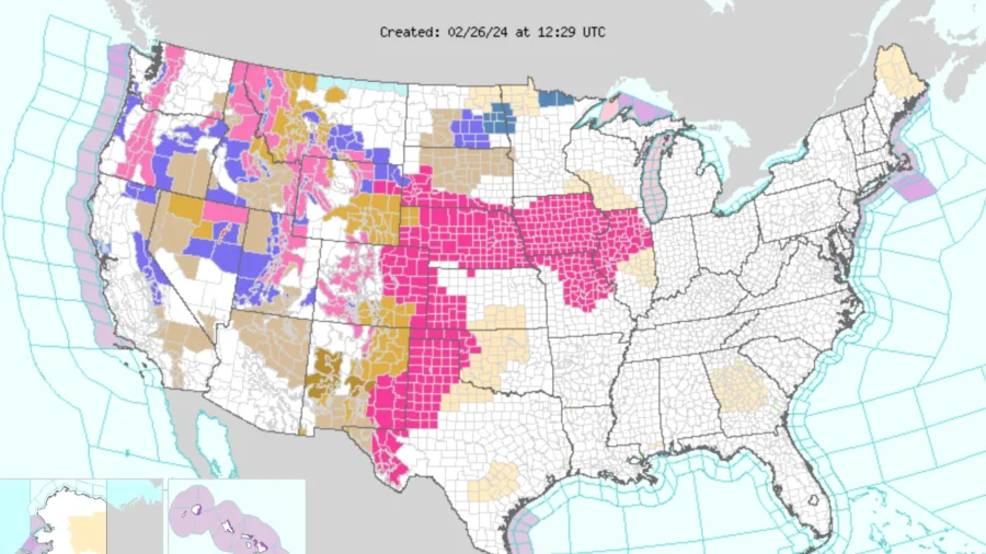
Severe weather, including scattered thunderstorms and possible tornadoes, is likely to affect multiple parts of the Midwest throughout this week, according to forecasters.
The severe weather, which is due to a powerful cross-country storm that started on Feb. 25, is expected to bring heavy mountain snow and blizzards to the West of the United States.
A “strong northern-stream trough will dig southeast into the Great Basin by the end of the period. This evolution will suppress the height fields across most of the western US,” according to the National Oceanic and Atmospheric Administration’s (NOAA) Storm Prediction Center.
“These snow rates combined with winds gusting 50-65 mph will produce near-blizzard conditions with significantly reduced visibility and snow-covered roads leading to dangerous travel,” according to NOAA.
Some areas will experience more than 2 feet of snow as a result, and some up to 4 feet of snow in elevated areas. NOAA reported that some lighter snow accumulation is also expected on lower valley planes.
As the storm advances eastwards, it will likely impact Midwestern cities, including St. Louis, Chicago, and Indianapolis by Feb. 27, according to the National Weather Service.
Forecasters have warned that scattered, strong to severe thunderstorms are expected to sweep through parts of the Ozarks, the mid-Mississippi Valley, and the southwestern Great Lakes. These storms are likely to bring hail and cause wind damage, with the potential to persist well into the night of Feb. 27.
“Our nation’s midsection is going to be on tap to deal with the severe weather as this cross-country storm works its way eastward,” FOX Weather meteorologist Kendall Smith forecasted on February 25.
Close to 50 million people could be affected by the severe weather conditions, according to estimates.
The severe weather threat was initially predicted to last into Feb. 28, however, it was downgraded from an earlier forecast at the weekend. Linda Lam, lead meteorologist at the Weather Channel, said some details and specific risks are expected to change over the next day or two.
The Weather Channel also warned that areas from northern Arkansas into western Ohio and Michigan could experience severe storm conditions, starting in the afternoon of Feb. 27, and advancing further into the following day.
The severe weather conditions are attributed to a combination of a powerful jet stream, a strong low-pressure system, and what is referred to as abnormally warm temperatures. These elements, combined with moisture moving northward from the Gulf of Mexico, create favorable conditions for the storm, according to the Weather Channel.


