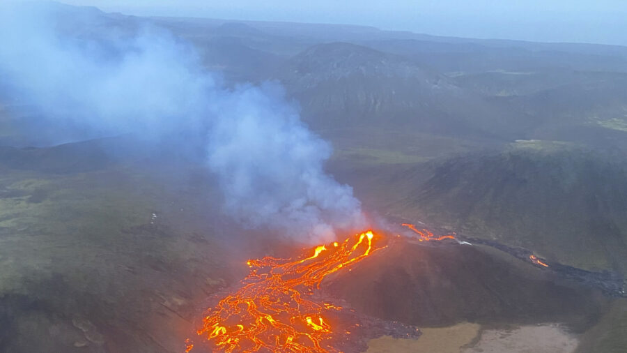
Iceland experienced yet another volcanic eruption on Feb. 8, less than two months after the eruption of the Svartsengi volcanic system in December, which saw the evacuation of the coastal town of Grindavik.
The eruption began on Thursday at around 6 a.m. local time. According to Iceland’s Meteorological Office, lava starting spewing out of a roughly 2 mile-long fissure northeast of Mount Sundhnukur.
Imagery captured by the Icelandic Coast Guard showed the eruption occurring in the same area as the one on Dec. 18. Met Office data indicated that the lava flow was heading westwards, with no immediate threat to the town of Grindavik or to a major nearby power plant.
The Blue Lagoon thermal spa, one of Iceland’s biggest tourist attractions, which is located in the area, was closed as the volcano erupted, with guests moved to hotels, Iceland’s national broadcaster RUV reported.
Iceland’s Reykjanes Peninsula has experienced three volcanic eruptions since December. The region is also the location of Iceland’s main airport, Keflavik, which so far has not been subject to any disruptions as a result of the volcanic activity.
Iceland experiences volcanic eruptions every four to five years, on average. The area is prone to eruptions due to its being located above a magma hotspot in the northernmost section of the Mid-Atlantic Ridge.
While many eruptions have little effect on daily life on the island, as well as on air traffic, the most disruptive volcanic event in recent years happened in 2010, when the Eyjafjallajokull volcano spewed huge clouds of ash into the atmosphere, leading to widespread airspace closures across Europe.
When the Svartsengi volcanic system awakened in November after lying dormant for almost 800 years, it forced the evacuation of nearly 4,000 people from the nearby town of Grindavik. The town is located around 30 miles southwest of Iceland’s capital, Reykjavik.
Prior to its initial eruption on Dec. 18, a series of earthquakes caused large cracks to open in the earth between the town and Sylingarfell, a small mountain to the north.
As the volcano erupted, slow-moving rivers of lava moved away from Grindavik, followed by a second eruption on Jan. 14, which saw lava moving toward the town.
Defensive walls that had been bolstered since the first eruption stopped some of the flow, but several buildings were consumed by the semi-molten lava.
The eruption, which marked the 5th eruption on the Reykjanes Peninsula in the past four years, was officially declared to be over on Jan. 16.
Other notable volcanic eruptions on Iceland include the Fagradalsfjall volcanic system, which awakened in early 2021 after lying dormant for around 6,000 years; the eruption on Bardarbunga, which last erupted in 2014; Hekla, which last erupted in 2000, and Grimsvotn, which was last active in 2011.
Another subglacial volcano, Katla, is located beneath a thick layer of ice. The volcano’s latest activity was recorded in 2011, although it didn’t break through the ice, which has given rise to speculation that a significant eruption could occur there in the near future.
The Associated Press contributed to this article.


